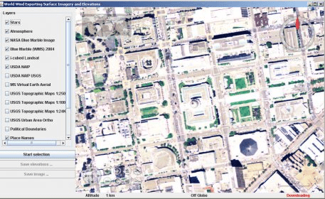
World Wind Exporting Surface Imagery and Elevations demonstrates how to use the SectorSelector utility to save a selected region of surface imagery and elevations to a GeoTIFF file.
This application is simple to use and it doesn't require installation. You can launch it via Java Web Start.
Comments